


Slide title
Write your caption hereButton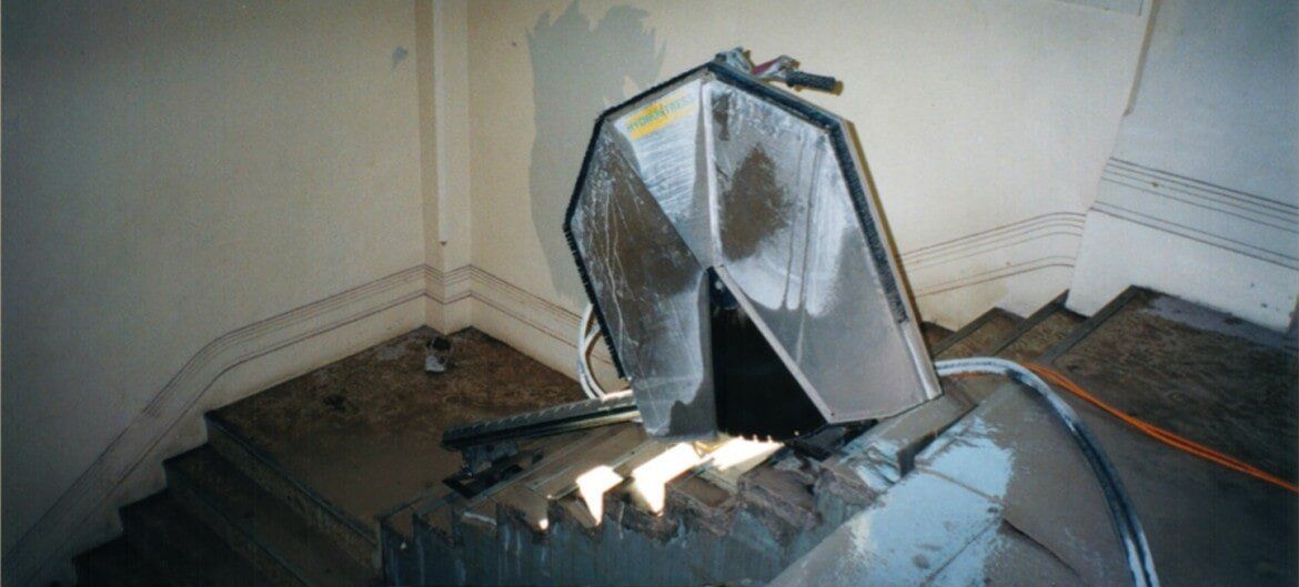
Slide title
Write your caption hereButton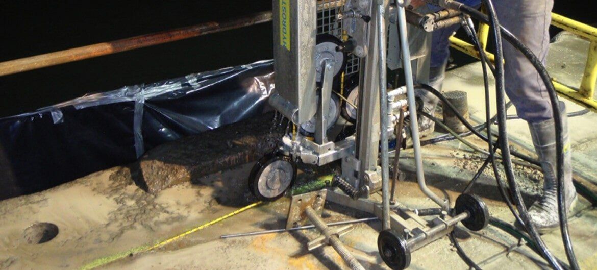
Slide title
Write your caption hereButton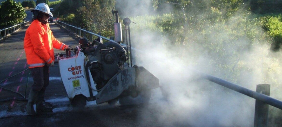
Slide title
Write your caption hereButton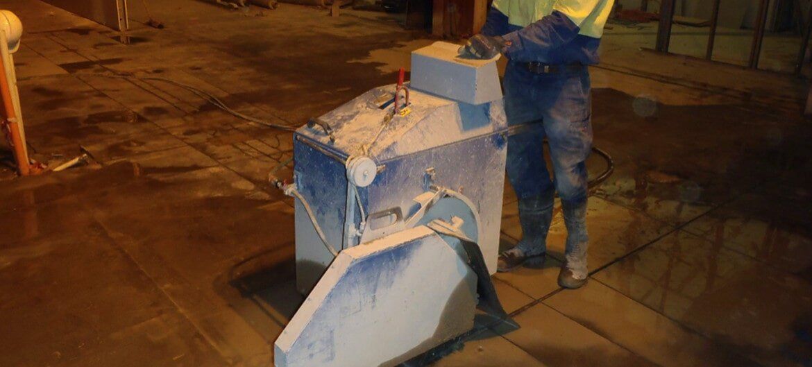
Slide title
Write your caption hereButton
-
Slide title
Write your caption hereButton -
Slide title
Write your caption hereButton -
Slide title
Write your caption hereButton -
Slide title
Write your caption hereButton -
Slide title
Write your caption hereButton
-
Slide title
Write your caption hereButton -
Slide title
Write your caption hereButton -
Slide title
Write your caption hereButton -
Slide title
Write your caption hereButton -
Slide title
Write your caption hereButton

AristoScan, a division of Aristocut (Townsville) Pty Ltd, offers a non-invasive location of utilities, inspections of walls and floors, and measurement of slab thicknesses, using a ground penetrating radar. We operate throughout Townsville, Mackay, Mount Isa, Cairns and the entire North and Far North Queensland region.
Our radar is state-of-the-art, one of the most accurate available on the market, with features enabling it to quickly and efficiently detect underground services, as well as provide specs on all types of concrete structures, from walls and floors, through to driveways and paths.
We can also provide a detailed report, as well as a 3D image highlighting the results of the radar surface scan.
Contact us today for your complete domestic, commercial and industrial radar needs.
Ground Penetrating Radar
Aristoscan, a division of Aristocut (Townsville) Pty Ltd is based in Townsville. We are locally owned and operated and have built a reputation for providing a prompt and professional service. We operate throughout Townsville, Mackay, Mount Isa, Cairns and the entire North and Far North Queensland region. We have been utilising GPR in our work since 2005.
Our GPR equipment is state-of-the-art, some of the most advanced and accurate available. We have a range of GPR equipment suitable for multiple applications in scanning concrete structures and ground utilities. We can provide detailed reports in 2D and 3D detailing your specific requirements.
Utility locating and mapping is an additional service Aristoscan is pleased to be providing. We use a precision EM (Electromagnetic) Locator which has multiple inbuilt antennas and all the latest features to ensure your assets are located prior to excavation. We have the ability to back this up using a GPR unit to verify or to locate nonconductive lines or pipes that an EM Locator cannot locate.
Contact us today for your complete GPR and utility locating needs.
ABOUT GPR (Ground Penetrating Radar)
Ground Penetrating Radar (GPR) is a geophysical non-destructive method used to produce images of the subsurface. It uses radar pulses to produce reflections which enable the user to identify and map features buried in the ground or in man-made structures.
Two of the main uses for GPR are concrete scanning and utility locating/mapping. It is necessary to complete these tasks prior to any excavations, whether it be for ground or concrete. Aristoscan has the GPR equipment available to complete this work. Please head to our services section to see a more detailed description of these.
There are many other uses for GPR and it is becoming more widely recognised and accepted in other fields. These include but are not limited to, geological work, earth sciences, finding unmarked graves, tree roots and rail line ballast.
As with all equipment, GPR does have some limitations in its use. Ground and soil conditions, weather and the properties of the object you are trying to locate, all play a part in the success of a GPR survey. If you are unsure if GPR can be used in your situation, please contact us and we can assist you to determine if we can help you with your project.


RADAR SERVICES
SERVICES INCLUDE:
- Non-destructive location of utilities
- Location of rebar, post-tensions, cable, conduits, etc
- Inspection of walls, floors, decks, slabs, tunnels, balconies and garages
- Slab thickness measuring
- 3D Scans available
- Reports available

CONCRETE SCANNING
AristoScan offers a non-invasive inspection of concrete structures. This includes, but not limited to, walls and floors, measurement of slab thickness, reinforcing mapping, post tension cables, conduits, detection of voids and any anomalies in the concrete structure using ground penetrating radar. Our latest concrete scanner has an inbuilt live power sensor, which assists in tracking live power in concrete.
Concrete scanning can be completed in 2D or 3D with the option of a detailed report for your records. It can be used in every construction site and operations for detailed analysis of the concrete structure and comparison with the as-built drawings. GPR scanning of concrete can also provide moisture content and the possibility of corrosion.
We have a range of concrete scanning equipment to suit almost any situation. We also have the ability to carry out large scale post tension cable mapping with geo referencing to cm accuracy using our multi-array GPR system.
We service the domestic, commercial and industrial sectors, and are happy to provide an obligation-free quote on request.


Utility Locating
This is a service we provide for basic utility locating. This is a cost-effective, non-destructive method and is generally completed prior to any excavation work.
This service utilises an EM (Electromagnetic) locator and accessories required to locate any services you are looking for. This could include, but not limited to, electrical, communications or water. There are occasions where a single or dual antenna GPR (Ground Penetrating Radar) unit may be used to verify or assist in this work, due to non-conductive utilities such as pvc pipes.
Any services located are marked on site using spray paint for your referencing.
Utility locating plays an important role. Any ground excavation has the potential to damage a utility service if not located prior, which could cause timely delays and costly repairs. The worst thing that could happen is injury or someone not returning home to their loved ones.
Utility Mapping
This method utilises GPS assisted software that can map your utilities on a cartographic background with cm accuracy.
Utility mapping eliminates the loss of the utility locates due to the loss of paint markings. It is also on your records for the life of the utility, so you only have to locate that service once.
For example, if you have a utility location completed for a job and that job is delayed for some reason, you may lose your markings from the locating which was marked out using spray paint. With the utility mapping service Aristoscan provides, you have no issues. You simply refer back to your site map which was completed on that given day.
For those larger projects, Aristoscan has a multi-array GPR unit, which utilises GPS with a cartographic background to provide cm accuracy of scanned utilities. This system scans approximately 900mm wide and produces 3D scans in a single pass.
An array GPR system is simply the term applied to a GPR system containing multiple transmitting and receiving antennas deployed over a spatial volume with fixed spatial locations defined for each element. Array GPR systems can be used to map large areas quickly and enable true 3D visualisation of the subsurface.
GPR arrays also enable faster data collection of a much richer dataset compared with traditional 2D systems. For example, a 32-antenna array with 4 cm antenna spacing can collect data 32 profile lines at 4 cm spacing in one swath, whereas a 2D system would need to collect 32 individual lines at 4cm spacing to replicate the result of an array. This is simply not economical. In saying that, there are circumstances where a single antenna unit is still required, so we still have this available for that very reason.


ABOUT US
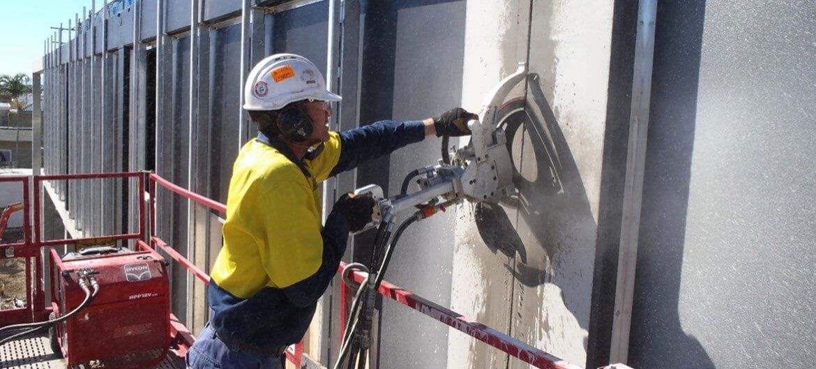
You can rely on Aristocrat (Townsville) Pty Ltd for your complete, concrete sawing, drilling and grinding needs throughout North Queensland.
For accurate location of utilities, cables and conduits, as well as wall, floor and slab inspection and measuring, we also have a separate division, trading as AristoScan, equipped with a powerful and efficient ground penetrating radar.
We service the domestic, commercial and industrial sectors, and are happy to provide an obligation-free quote on request!


ENQUIRY FORM
Contact Us
We will get back to you as soon as possible.
Please try again later.
ABOUT US
You can rely on Aristocut (Townsville) Pty Ltd for your complete, concrete sawing, drilling and grinding needs throughout North Queensland.
For accurate location of utilities, cables and conduits, as well as wall, floor and slab inspection and measuring, we also have a separate division, trading as AristoScan, equipped with Multiple GPR Systems to suit most situations.
We service the domestic, commercial and industrial sectors, and are happy to provide an obligation-free quote on request!

ENQUIRY FORM
Contact Us
Thank you for contacting Aristocut (Townsville) Pty Ltd. We will be in touch soon.
Please try again later.